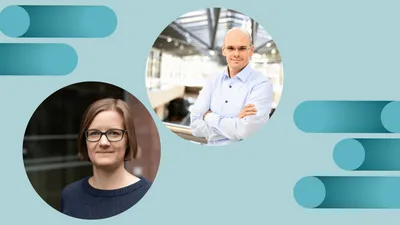
Kurz geplaudert mit... Dr. Josephine Jahn und Malte Specht
Zwischen Sensorik, Smart City und nachhaltiger Digitalisierung: Dr. Josephine Jahn und Malte Specht sprechen im Interview über Kooperationen zwischen Wissenschaft …
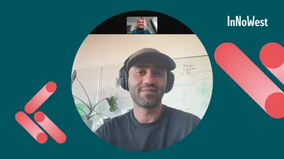
In this edition of our format, we had a quick chat with Qasem Safariallahkheili from our Digitalization team. We talked about the future of the MOSIDI app and the challenge of making it as user-friendly as possible – and why he misses the mountains in Brandenburg.
Qasem Safariallahkheili: I’m part of the Digitalisation team and affiliated with Potsdam University of Applied Sciences. My role focuses on developing web-based GIS solutions that support sustainable development and enhance user interaction. My work involves handling and visualising geographic data on both the backend and frontend sides of the application.
Qasem Safariallahkheili: Yes, that’s right. We are currently developing MOSIDI, a web-based application designed to host, store, process, visualise, and interact with various geospatial datasets. Especially decision-makers –particularly at the municipal level can use it. The goal is to help them better understand and interpret the complexity of these datasets. We are developing tools for all statistical levels of municipalities across Germany, and we have already conducted several successful user tests with local authorities.
We work with both demographic and environmental data that come from heterogeneous sources such as different geoportals and data providers. For instance, demographic datasets are sourced from INKAR, while environmental datasets are obtained from the Deutscher Wetterdienst (DWD), including variables such as precipitation, frost index, sunshine duration, and frost days.
Qasem Safariallahkheili: Within Germany, there are multiple institutions developing similar initiatives. For example, I connected with one of them at a conference in June. They are working on strategies for hosting and visualising demographic datasets across the country. Naturally, there are also various portals and solutions that perform functions similar to MOSIDI.
Looking ahead, I hope we can establish a communication framework and collaborative efforts with other organisations pursuing similar goals. This would help avoid redundancy, reduce duplicated efforts, and ensure that public resources are used efficiently. Achieving this requires significant work at the management and coordination level.
Qasem Safariallahkheili: I completed my bachelor’s degree in Geomatics and for my master’s, I specialised further in Geographic Information Systems (GIS). Subsequently, I worked as a researcher at the French National Geographic Institute in Paris, focusing on 3D geo-visualisation.
In my professional work, I cover the full GIS workflow, with a particular focus on database management, geospatial data visualisation, spatial analysis, AI, and enabling interactive queries and exploration. My responsibilities include gathering and integrating geographic data, cleaning and structuring it for storage, and preparing it for analysis and visualisation to ensure it can be effectively used for decision-making within MOSIDI.
Qasem Safariallahkheili: I primarily work with open-source geospatial technologies. For example, we use PostgreSQL with PostGIS as our database to store, manage, and index geographic data. I use Python for developing the backend APIs and data processing, while JavaScript handles the frontend logic and connects the user interface with the backend services.
As technology evolves rapidly, it’s crucial to stay up-to-date with the latest scientific developments and leading-edge tools in my field. This requires continuous research, including reading scientific papers, reviewing blog posts, and participating in innovative conferences and events.
Our work is always guided by user requirements, serving as the bridge between the technologies we use, the project goals within the InNoWest team, and the needs of the users.
Qasem Safariallahkheili: One of the main challenges is user engagement – specifically, how to encourage municipalities to use the application and build their trust in it. To address this, we need to communicate the credibility of our visualisations and the underlying data. One solution is providing metadata, which describes the sources, accuracy, and reliability of the data.
Another challenge is the comprehensibility of results and visualisations. Our users range, and not all of them have expertise in cartography or working with geospatial data. Therefore, we need to make maps and analytical results intuitive and easy to interpret.
One potential strategy we are exploring is using large language models (LLMs) to generate textual summaries of visualised results. This allows users to understand the data both visually and through explanatory text, improving accessibility for a wider audience.
In summary, our key challenges are engaging users, building trust, and making the application understandable across different user groups.
Qasem Safariallahkheili: We envision that future maintenance and development of MOSIDI could be supported by an organisation with which we are already in communication. MOSIDI’s modular and simple architecture makes it a flexible and extensible application. Future maintainers could easily add new modules or plugins on top of the existing system, allowing the platform to evolve and continue supporting municipalities and decision-makers effectively.
Qasem Safariallahkheili: One of my favourite moments is when I solve intellectual challenges while working at my desk. I really enjoy finding a solution to a scientific question and then implementing it in code. It feels almost like a ritual – the transition from a theoretical concept to something practical and usable.
Additionally, receiving feedback from users who find the application useful and engaging brings me great satisfaction. It reinforces the sense that my work is meaningful. Ultimately, I would be thrilled to see decisions at the municipal level being informed by MOSIDI. I know that’s an ambitious goal, but it’s precisely what we are striving to achieve.
Qasem Safariallahkheili: During the summer, if the weather is warm enough, I like to bike to Erkner. I really enjoy the lakes and surrounding forests – the area is beautiful, less crowded, and offers a sense of intact nature compared to other places.
Overall, I appreciate Brandenburg for its unique geographical features, including forests, lakes, and greenery. On the other hand, one thing I miss is topography – Brandenburg is mostly flat. I come from a region between the Caspian Sea and the Alborz Mountains, so I enjoy seeing mountains on the horizon or being near water, which adds a different kind of natural beauty.
Qasem Safariallahkheili: I would like to see more meaningful collaborations between the different teams. It would be wonderful if, by the end of the project, all the components developed by the teams could intersect and complement each other. I imagine that many innovations have been made across teams that we might not even be aware of. By working together, we could create something more powerful and impactful.

Learn more about their projects and cooperations.
Kommunikation und Social Media
Zwischen Sensorik, Smart City und nachhaltiger Digitalisierung: Dr. Josephine Jahn und Malte Specht sprechen im Interview über Kooperationen zwischen Wissenschaft …
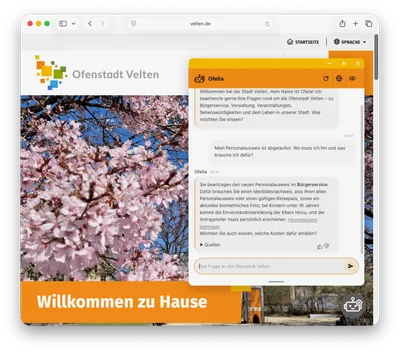
Am 19. Mai 2026 ging „Ofelia" live: Der KI-Chatbot, den das Team Digitalisierung gemeinsam mit der Stadt Velten entwickelt hat, beantwortet auf der kommunalen …